#
How web developers can use GIS data & Pozi
Traditionally Geographic Information Systems (GIS) have been a hidden resource of data portals used by organisation staff to deliver critical customer service on location based information.
But, with the digital age comes digital communication and the need to transparently deliver as much of your knowledge to the community with UX (user experience). This includes your GIS data.
In recent times, web based maps for GIS have sat at the extremes of accessibility for organisations – either expensive applications delivered in complex formats, or simplistic tools that, whilst being inexpensive or even free, such as Google Maps, don’t deliver your unique data.
This is where Pozi comes in. Custom web maps that deliver unique local data in a user friendly platform, increasing customer engagement and all at an affordable price with no lock-in contract.
Here are some of the ways Pozi allows web developers to use GIS data beyond data portals and increase customer's online user experience.
#
Custom Map
Launch an online map with specific layers so customers see your customised map pre-loaded with the layers you choose for them. The City of Greater Bendigo configured a custom Pozi map to help residents understand how their property may be affected by proposed changes to the city's flood overlays.
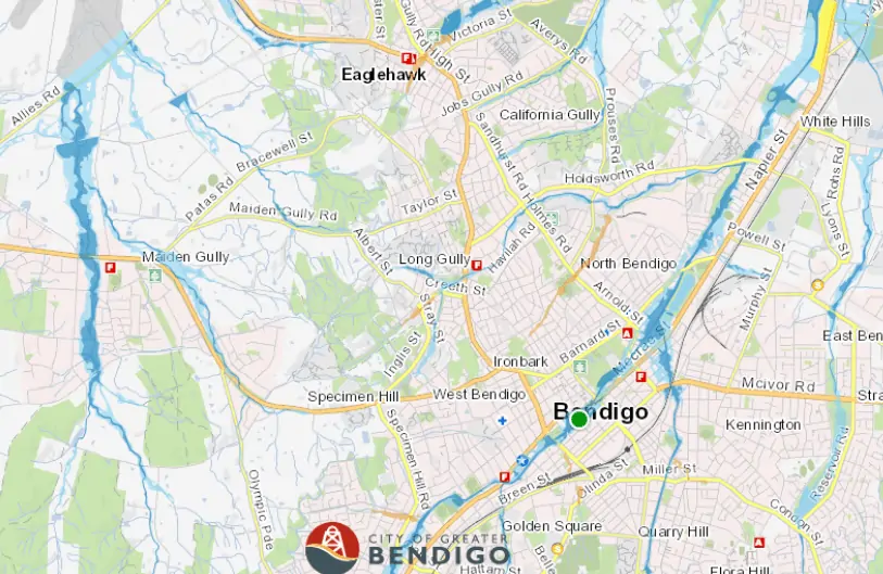
City of Greater Bendigo's custom Pozi map to help residents with updated flood overlays
Northern Grampians Shire Council created a custom map for their site that highlighted and promoted various local events in the region.

Northern Grampians Shire Council created a custom map to promote local events
Horsham Rural City Council customised Pozi to promote (transparently) their capital works in the region to ratepayers.
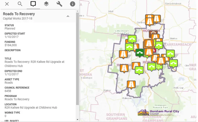
Horsham Rural City Council customised Pozi to promote capital works
#
Map Widget
Invite customers to view their personalised custom map by prompting them to enter their address into a Pozi Map Widget. When the user selects from the autocomplete address options, Pozi launches their map focused on their property (or location) so they can discover services and facilities relevant to them.
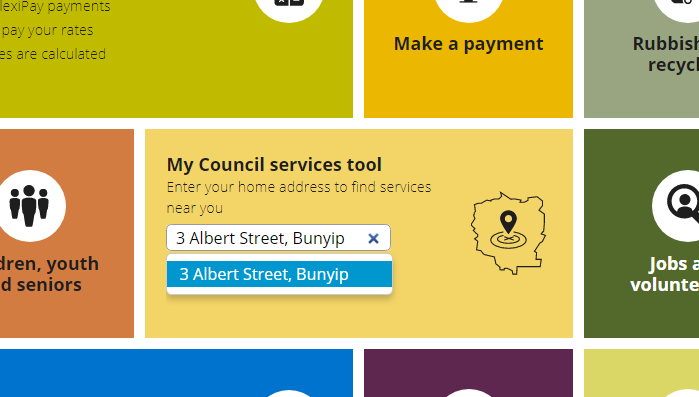
Cardinia Shire Council features an address search widget (called My Council Services Tool) on their website home page that launches a Pozi map with information based on the street address entered. Visit https://www.cardinia.vic.gov.au/ and use “3 Albert Street” as example address, and see it in action.
#
Data Widget
Another example of how Cardinia Shire Council is leading the way in user friendly web design utilising Pozi and uses a Data Widget on its homepage as an address search bar to display property-specific information.
See Cardinia's Pozi Data Widget in action here * (Use “3 Albert Street” as example address)*
#
Embedded Map
Rather than embedding a Google Map on your website that promotes information Google has collated, Pozi allows you to embed a map with your uniquely collated location data. Simply use an HTML iframe to embed a Pozi within your web page.
#
Google Forms
The latest Pozi developer tool is integration with Google Forms so users can submit details, provide feedback or report issues about locations and features.
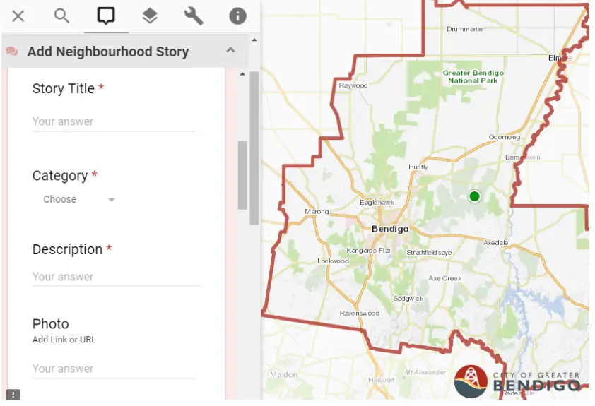
City of Greater Bendigo uses Google Forms on Pozi as part of their Neighbourhood Stories initiative. When residents click on a map location a form appears called 'Add Neighbourhood Story' with fields to submit their favourite location’s details.
If you’re ready to discover how Pozi can help you communicate your GIS data online, contact us today and get started on a free, no obligation, 60 day trial.