#
Pozi web map helps Macedon Ranges shape its Biodiversity Strategy
We have previously discussed some creative ways organisations are integrating Pozi as part of customer service and community engagement. But, one of the more exciting and interesting uses for Pozi of late is how our web map helped Macedon Ranges shape its Biodiversity Strategy. To explain, let's start at the beginning...
#
Macedon Ranges Shire Council Biodiversity Strategy
Biodiversity is becoming increasingly important in communities around Australia. Not only do we better understand the importance of biodiversity for the longevity and sustainability of the environment, we also appreciate it’s what makes our area unique.
When Macedon Ranges Shire Council implemented a new biodiversity strategy, one of its aims was: “Ensure community and government are working collaboratively towards a shared vision for biodiversity conservation”. And the Council wanted community information to inform their final strategy and future assessment study for the shire.
With their aim to engage and collaborate with community for their strategy, the Council needed an online platform to collate data from residents on the biodiversity of their area.
The online tool needed to be user friendly for the public to not only submit information, but pinpoint the location/s of their biodiversity stories.
After seeing the Pozi app in practise helping City of Greater Bendigo collect community information for its Neighbourhood Stories campaign, Macedon Ranges contacted the team at Pozi about implementing a similar online Community Mapping Survey.
#
Customers helping shape organisational GIS data
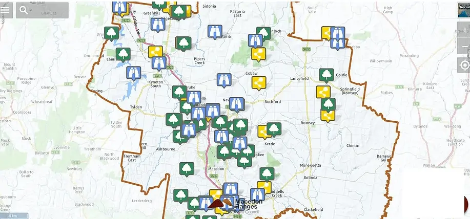
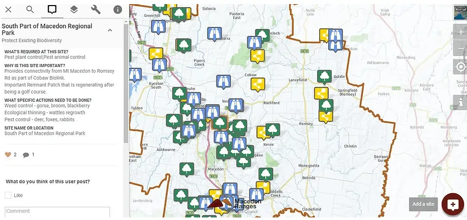
What was created between Pozi and Macedon Ranges Shire Council was an online map customised and focused for the Council’s strategy and their end users – their residents – that’s simple to use and that could collect three sets of information with data integrating seamlessly with the map. The Council simply promoted a link for residents to click that opens a map of their Shire. They then either type in an address or click on a specific location on the map and click "add a site". A form opens and users choose one of the three topics (special landscapes, protect existing biodiversity, or connect and create biodiversity) and fill their details and submit.
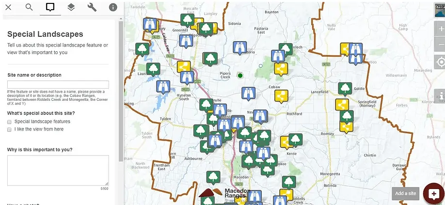
Pozi opens an integrated form. Users choose the appropriate category and fill in their details before submitting
Users also have the option to upload their own photos. Residents were also given the opportunity to submit contributions to the strategy at community drop-in sessions and by writing, but the Pozi app’s metrics has shown incredible traffic and visits to their website that has exceeded expectations – thanks to great marketing by the Council. What started as a blank map of the Macedon Ranges' region was soon populated with community information. Information that not only helps the Council shape its strategy, but move forward with real insight from its customers about what they value.
#
GIS: A new form of social media?
Beyond contributing location data, users can also engage with others’ information by liking and commenting on map submissions. This takes the GIS information to another level. Not dissimilar to social media, community were given a platform to not only engage with the Council but fellow residents and add their extra insight (or opinion) to other's posts.
Members of the community can view all submissions on the map and like posts, just like social media
Community can also add their own comments to other residents' submissions. All comments are moderated by Administrators ensuring online safety.
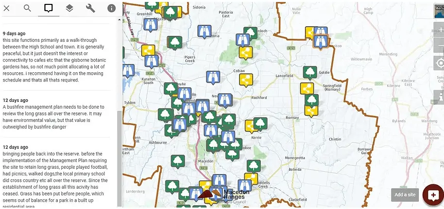
Macedon Ranges' residents engaged with each other's biodiversity submissions
All comments made on the Pozi app are moderated with an email notifying administrators with any new comment, ensuring online safety and protection of data.
#
Pozi & Council building a community
This Pozi project has not only facilitated data collection for Macedon Ranges Shire Council, but connections between the Council and its residents, and residents with each other. All building a community that will help shape and save its unique and cherished biodiversity for their families and people beyond the Shire to enjoy long into the future.
For us at Pozi, it's been an exciting project to work on and see exceed expectations, again showing the power of public facing GIS data for customer service and excellence.
If you'd like to learn more how we can implement a similar GIS application for your organisation, get in touch for a friendly chat.